

Coraddie [Beinn Bhreac]
Good walks are even better shared.
Overview
Coraddie [Beinn Bhreac]
Introduction
Nestled in the heart of the Scottish Highlands, Coraddie, also known as Beinn Bhreac, rises majestically to 849 meters. This Munro isn’t just another peak; it’s a gateway to stunning landscapes and exhilarating outdoor adventures.
Geology
Did you know this rugged beauty is mainly composed of schist and granite? These ancient rocks tell tales of geological processes over millions of years. The glacial valleys contoured by ice still hold secrets for those curious enough to notice the fascinating formations beneath their feet.
Routes
One of the most popular routes begins in the Glen, where you’ll meander through verdant forestry before scaling rocky outcrops. It’s a moderate hike, suitable for the average hillwalker, spanning approximately 14.5 km and taking around 5 hours. Don’t forget a snack for the summit—nothing like a scone with a view!
Summit Features
At the summit, you’ll encounter a prominent stone cairn that not only marks your triumph but provides an ideal spot for a well-deserved rest. The panorama from up here? Absolutely breathtaking!
Terrain
Expect a delightful mix of grassy slopes interspersed with rocky paths—and yes, a few boggy patches that might test your footwork skills. Always good to practice your “graceful fall” technique, just in case.
Views
From the top, the sights are nothing short of spectacular. On a clear day, the Cairngorms, Loch Awe, and even Ben Nevis might grace your line of sight. The best time to take advantage of these vistas? Spring and early summer when the air is crisp and visibility is at its peak.
Hazards
While nature is a wonderful friend, it can also be quite the diva! Be prepared for quick weather changes and watch your step on those loose rocks, especially if Scotland decides to show off its famous rain.
Nearby Summits
After conquering Coraddie, why not extend your adventure to nearby summits like Beinn Mholach? Every peak unveils new treasures waiting to be explored.
Access
Parking is available at the Glen route, but it’s limited. Get there early, or risk the dreaded roadside park! Public transport is a mixed bag, so do your homework before heading out. Strathaven is your nearest town, perfect for stocking up on supplies.
Facilities
Facilities are few and far between on the mountain itself. Save your comforts for Strathaven, where you can find cafes and toilets.
History
The name Beinn Bhreac, which means 'speckled mountain', hints at the lovely blotches of terrain visible from afar. This mountain is steeped in local lore, with ancient clans serving as its guardians. So, if a ghostly figure appears, just politely ask for directions!
As you prepare for your hike, remember to respect the environment and enjoy every step of your adventure up Coraddie. Happy trekking!
Explore routes near Coraddie [Beinn Bhreac]
Public walks starting within 80 km of this hill. Nearby does not mean a route reaches the summit; check its map and access before setting out.
Glen Kin group walk
View route
Bishop’s Glen group walk
View route
West Bay walk and talk
View route
West Bay walk and talk
View route
Route planning notes
These notes describe possible approaches, not verified navigable routes or permission to cross land. Check current paths, local access rules and conditions before setting out.
From the Glen
A popular route that starts from the picturesque Glen and takes you through lush forestry before scaling the rocky inclines towards the summit.
Make a day of it, together
Find someone to share the walk with, or organise a day out along a route you like.
Photo Gallery
View all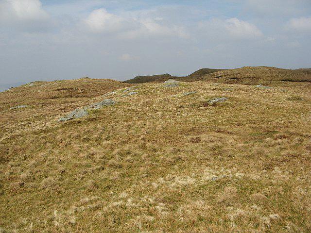 Photo could not load
NS0477 : Summit area, Beinn Bhreac
Richard Webb
Hill facts and local notes
Classifications
Elevation
519m
1,703 ft
Prominence
371m
Coordinates
55.9541, -5.1249
NS050778
OS Map
63
Explorer: OL37S 362N 363S
At the Summit
The summit features a prominent stone cairn along with a stunning panoramic view that stretches across the Highlands.
Terrain & Geology
The area is primarily composed of schist and granite, with glacial erosion having revealed fascinating rock formations that make for a stimulating geological study, not to mention great selfies!
Views & Scenery
From the summit, you can see the stunning expanse of the Cairngorms, Loch Awe, and on a clear day, as far as Ben Nevis in the distance.
History & Heritage
Name Origin
The name 'Beinn Bhreac' translates to 'speckled mountain' in Gaelic, perhaps a nod to its mottled appearance when viewed from a distance.
Historical Significance
The area has historical significance tied to ancient Scottish clans, with many legends connected to the Highlands.
Getting There & Facilities
Check current local access restrictions, parking rules and transport timetables before travelling. These notes do not confirm public access to the summit.
Parking
There is a small parking area at the start of the Glen route, accommodating around 10 cars. Arrive early to secure a spot!
Public Transport
Public transport options are limited, but local buses do service nearby villages. Check the latest timetables for available routes.
Nearby Facilities
There are no facilities on the mountain, but Strathaven has cafes and toilets, so plan your visit accordingly.
Safety Information
Known Hazards
- Be cautious of sudden weather changes—always remember, in the Scottish mountains, it might be sunny while you're getting drenched!
- Loose rocks and steep drops can be treacherous, especially in wet conditions.
General Safety Tips
- Check weather conditions before setting out
- Carry appropriate clothing and equipment
- Let someone know your planned route
- Take a map, compass, and GPS device
- Carry emergency supplies: food, water, first aid kit, torch
Hills
Some common questions about the hills answered
Are there group walks up Coraddie [Beinn Bhreac]?
Many walkers use Walkmates to join or organise walks with others. You can check for group walks around Coraddie [Beinn Bhreac] through the maps
Are there other walkers around Coraddie [Beinn Bhreac]?
Activity varies by location and time, but Walkmates lets you see whether others have shared walks or shown interest in this area. Find other people through the walking friends search walking friends for Coraddie [Beinn Bhreac] search or of course create your own walk for Coraddie [Beinn Bhreac]
Can I organise a walk to Coraddie [Beinn Bhreac]?
Yes. If there aren’t any walks listed already, you can create a walk and make it available for others to join.
If you're signed up to Walkmates, you can create a walk to Coraddie [Beinn Bhreac].
How do I find a walk up this hill?
There are often multiple ways to walk this hill, depending on experience and route preference. Walkmates helps you explore walks and routes that others have shared.
Can I suggest a new route up Coraddie [Beinn Bhreac]?
Yes. You can suggest or create routes to share with others. Walkmates focuses on the social side of walking, so routes are used to help people organise walks and explore areas together, rather than as detailed navigation tools or route libraries.
Other uses really appreciate knowledgeable walkers sharing their routes. Share your favourite route to Coraddie [Beinn Bhreac] here
The is an error or something incorrect about this hill. How do I let you know?
We always strive to keep the information on Walkmates as accurate as possible. If you find an error, please let us know through the contact form and we'll aim to correct it as quickly as possible
Community Discussion
Comments
Location
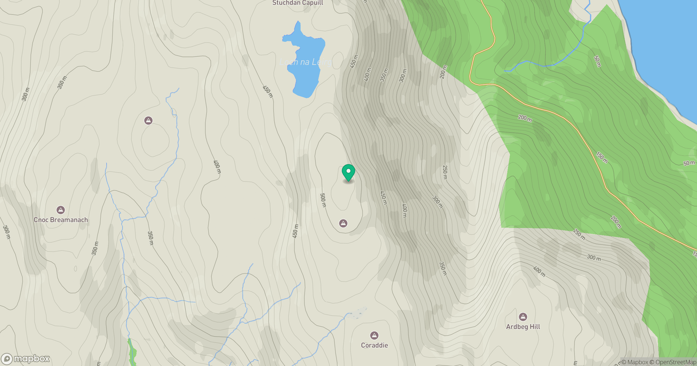
Grid reference: NS050778
View on OpenStreetMapOpens a map in a new tab, centred on the hill.
Hills within 30 km
Straight-line distance, not a walking route or confirmation of access.
No comments yet. Be the first.